Monday, March 7, 2011

SARAL satellite to monitor the sea water level


India plans to launch SARAL (Satellite with ARGOS and ALTIKA) satellite to monitor the sea water level. 
SARAL satellite will carry:
- An Altimeter (ALTIKA) for studying the sea surface heights.
- An ARGOS payload, which is a satellite based data collection platform.
SARAL satellite is a joint project of:
- Indian Space Research Organisation and
- French National Space Agency. 
The ALTIKA and ARGOS payloads are built and supplied by the French National Space Agency. The satellite building and launching are the responsibilities of Indian Space Research Organisation.
The satellite bus is under fabrication at Indian Space Research Organisation. Integration and testing of the payloads are ongoing at the French National Space Agency. The satellite is likely to be launched in 2011

Monday, December 22, 2008

National Highways - India

NH1:
Delhi - Ambala - Jalandhar - Ludhiana - Amritsar - Atari (Indo-Pak Border)
Length in State(s): Delhi (22), Haryana (180), Punjab (254)
Total Length: 456 km


NH2: 
Delhi - Agra - Kanpur - Allahabad - Gaya - Dhanbad - Kolkata
Length in State(s): Delhi (12), Haryana (74), Uttar Pradesh (752), Bihar (202), Jharkhand (190), West Bengal (235)
Total Length: 1465 km


NH3:
Agra - Gwalior - Indore - Nasik - Thane - Mumbai
Length in State(s): Uttar Pradesh (26), Rajasthan (32), Madhya Pradesh (712), Maharashtra (391)
Total Length: 1161 km


NH4:
Thane - Pune - Hubli - Bangalore - Chittoor - Chennai
Length in State(s): Maharashtra (371), Karnataka (658), Andhra Pradesh (83), Tamil Nadu (123)
Total Length: 1235 km


NH5:
Cuttack - Bhubaneswar - Visakhapatnam - Vijayawada - Guntur - Nellore - Chennai (Junction with NH 6 near Baharagora)
Length in State(s): Orissa (488), Andhra Pradesh (1000), Tamil Nadu (45)
Total Length: 1533 km


NH6: 
Hajira - Dhule - Nagpur - Raipur - Sambalpur - Baharagora - Kolkata
Length in State(s): Maharashtra (813), Chattisgarh (314), Orissa (462), Jharkhand (22), West Bengal (161), Gujarat (177)
Total Length: 1949 km


NH7: 
Varanasi - Rewa - Jabalpur - Nagpur - Hyderabad - Bangalore - Salem - Madurai - Kanyakumari
Length in State(s): Uttar Pradesh (128), Madhya Pradesh (504), Maharashtra (232), Andhra Pradesh (753), Karnataka (125), Tamil Nadu (627)
Total Length: 2369 km


NH8: 
Delhi - Jaipur - Ajmer - Udaipur - Ahmedabad - Vadodra - Mumbai
Length in State(s): Delhi (13), Haryana (101), Rajasthan (688), Gujarat (498), Maharashtra (128)
Total Length: 1428 km


NH9: 
Pune - Solapur - Hyderabad - Vijayawada - Machillipatnam
Length in State(s): Maharashtra (336), Karnataka (75), Andhra Pradesh (430)
Total Length: 841 km


NH10: 
Delhi - Fazilka - Indo-Pak Border
Length in State(s): Delhi (18), Haryana (313), Punjab (72)
Total Length: 403 km


NH11: 
Agra - Jaipur - Bikaner
Length in State(s): Uttar Pradesh (51), Rajasthan (531)
Total Length: 582 km


NH12: 
Jabalpur - Bhopal - Kota - Bundi - Tonk - Jaipur
Length in State(s): Madhya Pradesh (490), Rajasthan (400)
Total Length: 890 km


NH13: 
Solapur - Chitradurga - Shimoga - Mangalore
Length in State(s): Maharashtra (43), Karnataka (648)
Total Length: 691 km


NH14: 
Beawar - Sirohi - Radhapur
Length in State(s): Rajasthan (310), Gujarat (140)
Total Length: 450 km


Sunday, December 21, 2008

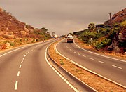
Indian Highways

  • Indian Highways constitute approx 2% of total road networks of India, but carry approx 40% of the total traffic.
Total length of highways: 67,000 km
Total length of expressways: 200km

  • The shortest NH is the NH47A, which spans 6 km, to the Ernakulam - Kochi Port.

Expressways:

Gurgaon Expressway near airport exit
Chennai-Bangalore Expressway
  • Mumbai-Pune Expressway - The Mumbai-Pune Expressway is India's first 6-lane, concrete, high-speed, tolled, access-controlled expressway.
  • Delhi-Noida Direct Flyway is a eight-lane access controlled tolled expressway which connects Delhi to Noida, an industrial sub-urb area. It was built and is maintained by the Noida Toll Bridge Company Limited (NTBCL). NTBCL was developed under a Build-Own-Operate-Transfer (BOOP) model.

Wednesday, December 17, 2008

Demography (India) - Statistics

Population:

1,095,351,995 (July 2006 est.)

1,028,737,436 (2001 Census)


Rural Population: 

742,617,747 (72.2%) (2001 Census)


Urban: Age structure:

0–14 years: 30.8%
15–64 years: 64.3%
65 years and over: 4.9% (2006 est.)

The average age of Indians is 26 years.


Population growth rate: 

1.38% (2006 est.)

Birth rate: 22.01 births/1,000 population (2006 est.)

Death rate: 8.18 deaths/1,000 population (2006 est.)


Literacy rate: 

64.8%


Percent of the population under the poverty line: 

10%


Unemployment Rate: 

9.2%


Sex ratio:
At birth: 1.05 male(s)/female
Under 15 years: 1.06 male(s)/female
15–64 years: 1.07 male(s)/female
65 years and over: 1.02 male(s)/female
Total population: 1.06 male(s)/female (2006 est.)


Life expectancy at birth:

total population: 64.71 years
male: 63.9 years
female: 65.57 years (2006 est.)

Total fertility rate: 2.73 children born/woman (2006 est.)


Religions: 

Hindu 80.46%, 

Muslim 13.43%, 

Christian 2.34%, 

Sikh 1.87%, 

Buddhists 0.77%, 

Jains 0.41 %, 

Others or not stated 0.72% (2001 Census)


Scheduled Castes and Tribes: 

Scheduled Castes: 16.2% (2001 Census) 

Scheduled Tribes: 8.2% (2001 Census)


Languages: 

There are 216 languages/dialects with more than 10,000 native speakers in India. 

The largest of these by far is Hindi with some 337 million (the second largest being Bengali with some 70 million). 

22 languages are recognized as "official languages".

Monday, December 15, 2008

16th December, 2008

  • Birdflu outbreak in West Bengal
Malda district of West Bengal has been hit by bird flu again - the second time this year.
H5N1 virus is the scintific name of the birdflu virus.
It has killed at least 246 people worldwide according to the World Health Organization.
  • Approval for National Investigation Agency (NIA)
Cabinet also gave the go-ahead for a proposal to amend the Central Industrial Security Force (CISF) Act.

  • Estonia
Estonia was the first to allow its people to vote through internet ballots in last year's Parliamentary elections.
It is now hoping to allow its voters to cast their votes through their mobile phones in 2011.

Thursday, October 9, 2008

The Origin and Evolution of the Earth

Some facts to know

  • Big Bang Theory
This theory states that evolution of universe started with a very tiny, highly condensed particle with infinite density and infinite temperature.
At the "Big Bang" this tiny particle exploded violently and which led to a huge expansion. Imagine a balloon expanding with different dots placed on it. 
This happened around 13.7 billion years ago.
Our universe is still expanding.

  • Star formation
The distribution of matter and energy was not uniform in the the early universe. This led to the differences in gravitational forces and matters started to get drawn together. These formed the bases for the development of galaxies. A galaxy is a combination of several stars.
Diameter of individual galaxies range from 80,000 - 1,50,000 light years.
Each galaxy was formed by accumulation of hydrogen gases in the form of a very large cloud called Nebula. In due time this cloud developed localized clump of gases which condensed even further to form "Stars".
Stars formation is believed to have taken place some 5-6 billion years ago.

  •  Formation of planets
Stars are localized clump of gases with exceptionally high gravitational force. This force gave rise to rotating bodies of gases and matters around the clump. In due course these matters started to get condensed and developed in to small rounded lumps. These smaller lumps were called "Planetesimals" which collided amongst themselves and due to high gravitational forces between them sticked together to form large rounded bodies known as "Planets"

  • Our Solar System
The nebula forming our solar system is believed to form the planets around 4.6 billion years ago.
It consists of 8 planets, 63 moons and millions of smaller bodies like asteriods and comets.

Inner Planets (Also known as terrestial planets): Mercury, Venus, Mars, Earth
They are made up of rock and metals and have relatively high densities.

Outer Planets (Also known as Jovial planets): Jupiter, Saturn, Uranus, Neptune
They are made up of gases mainly Hydrogen and helium.

  • Why inner planets are rocky while others are in gaseous forms?
Inner planets are closer to sun, so because of solar winds their outer atmospheric gases get blown away leaving solid matter behind. Inner planets are relatively smaller thus have lesser gravitational force to hold the gases being blown away. While in case of Outer planets because of their distances from Sun, solar winds could not have pronounced effect.

  • The moon
It is believed to be formed by a giant impact between a celestial body 3 times of the size of Mars and the Earth. It blasted a large part of the earth in to the space creating Moon orbiting the Earth.
This event is believed to be happened about 4.44 billion years ago.